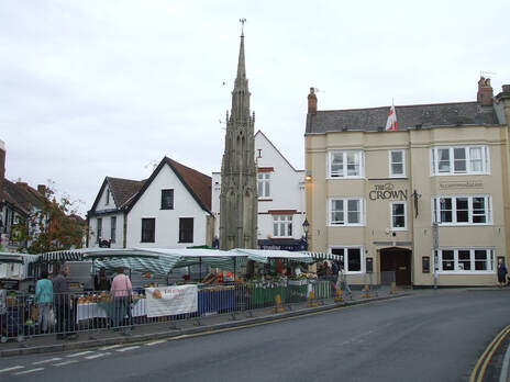
 Glastonbury Market Cross
WALK 5
GLASTONBURY (EAST)
Glastonbury Abbey and Tor and a defensive earthwork
Complex route and steep climbs but terrific views
Distance 10.4 Km/ 6.5 miles
Total ascent/descent 130m
www.mapmyrun.com/routes/view/23903814
Revised Feb 2023 Comments to [email protected]
1 From the bus-stop (GR499 388) go S along Magdalene St (ie away from market cross). Pass the Abbey(1) ruins on L and at mini-roundabout go ahead (SP Frome). Where road bends sharp L go ahead into Butleigh Road. Descend gently, ignoring first L and cross stile on L just beyond Bretenoux Rd. Follow broad grassy path adjacent to road for 350m. At enclosure by small building go over stile on L, continue on road and turn L into Chalice Way [1.2Km]
2 (GR506 380) Along Chalice Way for 50m then go R through wooden gate and follow path 600m with hedge on L. Go through metal gate on L then L along road 70m to junction. Go R 150m to sharp L bend [0.9Km]
3 (GR512 378) Go over stile on R and ahead over second stile. Keep hedge on L, cross stile to second field and go straight over and through a narrow enclosed path. At end of third field cross stile by large grey house. Pass to L of building, then ahead keeping hedge on L. At gateway go ahead to R of farm buildings and through gateway to pass sports pitches with hedge on L ignoring wooden bridge. At end of field go through wooden gate and bear R to pass through edge of deciduous wood. At end go L with hedge on R to end of field, cross stile on R then bear 45 degrees R to the R end of hedge. Cross track and go along field with hedge on L. Go ahead over stile and bear 45 degrees R across large field to gateway by electricity pole. Go ahead with hedge on R and through gate ahead to track [1.8Km]
4 (GR530 378) Continue 200m and where track goes sharp L, continue ahead through first metal gate, keeping hedge on L. Where hedge ends, bear 45 degrees R to join fence on R to small ridge known as Ponter’s Ball(2). Descend to locate a stile and go ahead passing to L of cattle trough to gate. Bear slightly L to a Bristol gate, then bear L to another Bristol gate and along short track to reach a road. Go L 200m to the busy A361 [1.4Km]
5 (GR537 380) Cross with care, go L for 30m and take enclosed path on R. At end of path, go through gate and go diagonally to far L corner of the field to pass by the end of Ponter’s Ball(2). Cross double stile and go diagonally aiming for the large barn to locate a concrete track. Cross the fence and aim for the L end of the hedge over to the R. Continue in the same direction to the far R corner and go through gate to track. Go L, then ahead through a pedestrian gate, and continue along track. Go L through kissing gate to L of double metal gate and follow with fence on L through two more kissing gates to road by Norwood Park(3). Go L 30m then go R past pair of cottages (Gog & Magog) and climb for 1.1 Km to a junction [2.8Km]
6 (GR515 388) Go ahead 100m then L on track to Glastonbury Tor(4). Follow the path as it climbs steeply to the summit with far-reaching views. (Orientation table) [0.5Km]
7 (GR512 386) Descend by a less steep path via two gates and a short track to road. Go L 30 metres then R into Chilkwell Street. After 300m at mini-roundabout (if time divert 50m L to Somerset Rural Life Museum(5) go ahead passing the Abbey walls on L. Ignore Silver St, but take L turn down High St 400m to reach Market Cross. The bus-stops are to the L [1.9Km]
FOR A SHORTER WALK Distance 6.1 Km/ 3.7 miles
Follow to end of point 2. Continue along road for 700m to reach the A361. Cross with care, go L 270m then R (SP Ashwell Farm). After 250m bear R and then L into Basketfield Lane rising steadily to junction at point 5.
For car travellers:
Park with care in Challis Way and start the walk from point 2.
Refreshments:
Many options in Glastonbury
1 Glastonbury Abbey dates to the 7th Century and by the time of the Domesday Book (1086) was the richest in the country. It was rebuilt following a fire in the 13th Century but dissolved in 1539.
2 Ponter’s Ball is a defensive linear earthwork almost 1 mile long thought to be from the Iron Age.
3 Norwood Park Farmhouse is grade II* listed and the list description indicates that construction started about 1480 of a residence for the abbots of Glastonbury
4 Neolithic flint tools found at the Tor suggest the site has been visited and occupied throughout human prehistory. An earthquake destroyed a mediaeval church in 1275 and a second church was built in 1360s. The last Abbot of Glastonbury, Richard Whiting, was executed here. Only the tower remains.
5 Rural Life Museum, established in 1975, explores the social and agricultural history of Somerset. It is housed in buildings surrounding a 14th Century barn
