 Stoke St Mary
WALK 2
THORNFALCON (NAG’S HEAD)
Small villages and an ancient woodland
Lanes and tracks with one considerable long ascent
Distance 11.0 Km/6.8 miles
Total ascent/descent 159m
www.mapmyrun.com/routes/view/19423898
Updated August 2023 Comments to [email protected]
1 From the bus-stop (GR 282 230), go along the minor road beside the (now closed) Nag's Head. After 600m turn R into Ashe Farm Caravan site. Follow tarmac straight ahead (not R) to waymarked wooden gate, bearing slightly L with hedge on L on faint track up hill to a gate. Go ahead through trees and up steps to a gate to emerge in field. Aim to L of small hillock halfway between the power poles to locate a pedestrian gate at the far side. (If the field has cattle you may choose to skirt round to the right keeping the hedge on R). Go through the gate and go L 150m with great views as far as the Mendips to the R. Just beyond bench go L along waymarked track 400m to reach road. Go R and follow 330m to sharp R bend [1.9Km]
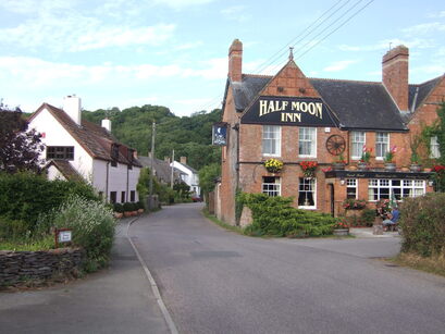
2 (GR273 221) Go along unsigned track on L for 500m at first a slight rise, then descending steadily through trees to reach road by gateway to Stoke House(1). Continue downhill along the road for 90m to join a more major road by the church. Continue ahead through the very pleasant village of Stoke St Mary(2) passing the Half Moon Inn to junction by village hall [0.9Km]
3 (GR262 222) Go L 800m then R at Greenway Farm for 650m passing the school and church. Where road bears R take the concrete track on L (SP Herepath(3) Trail) Go to L of the house, cross the small stream and follow the waymarked track through Thurlbear woods(4) in a steady ascent of 1.4Km to reach metal gate and road. Bear L along road for 80m to a junction and turn R for 60m to reach a fork [3.0Km]
4 (GR272 198) Go L (SP RSPCA Animal Centre(5) pass the Farmers Arms and continue 400m then go L opposite direction sign (no sign on our route) and follow1.8Km to West Hatch. At village take first L (Church Lane) and ascend gently 100m then R into churchyard. Exit via gate pass vilage hall and after 50m sharp L along drive of Perrington Lodge. Locate gate on R by entrance to The Willows [2.5Km]
5 (GR286 211) Go along path along edge of woods. Cross stile to open field to reach gate. Turn R, go over stile on R and keep hedge on R as it curves gently to L. At the far corner, cross stile through wooded area to reach another stile. Continue ahead with hedge on R and after 20m cross a stile and bridge. Go ahead with hedge on R and when trees are reached go L.100m beyond end of wood at large hedge gap ignore stile on R by metal gate, but go ahead, and after 80m go through hedge gap on R and keep hedge on R for 400m reach a road [1.4Km].
6 (GR277 219) Turn R and follow road for 1.3Km to reach the Nag's Head Inn. For Somerton, cross (with care) the dual carriageway and the bus-stop is on R. That for Taunton is to the L [1.3Km]
FOR A SHORTER WALK Distance 6.1Km/3.8 miles
Follow to Greenway Farm (point 3) and continue along the road 800m to junction. Go L for 60m then fork R and follow 1.7Km to the Nags Head.
For car travellers:
There is a lay-by in the lane opposite the Nags Head, 50m along on the L. Cross the busy A358 with great care
Refreshments:
Half Moon Inn, Stoke St Mary
Farmer’s Arms, West Hatch
1 Stoke House (visible from the road in point 3) was built in the early 19th century, possibly for Lord Portman’s agent. It is Grade II listed
2 Stoke St Mary has less than 500 people and was first mentioned in 854 AD. The church has one of the few 13th century towers in Somerset.
3 Staple Fitzpaine Herepath is a 20km circular path through the Blackdown Hills. A good start point is the car park at Castle Neroche. For map see www.gpsroutes.co.uk
4 Thurlbear Wood is a 65-acre Site of Special Scientific Interest managed by the Somerset Wildlife Trust. The woods are of considerable antiquity.
5 West Hatch RSPCA is one of two centres in the UK used for cleaning of seabirds covered in oil.
