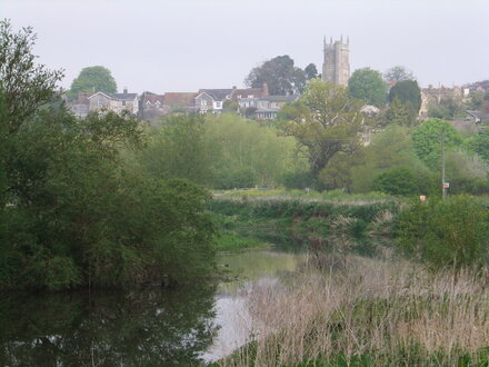
 River Parrett and Langport
WALK 7
LANGPORT
River Parrett, a ruined abbey and the “Hanging Chapel”
Pleasant paths and lanes with Bristol gates but few stiles
Distance 9.5 Km/ 5.9 miles
Total ascent/descent 25m
www.mapmyrun.com/routes/view/32100554
Updated April 2024 Comments to [email protected]
1 From the bus-stop (GR419 268) walk through the car-park opposite the Town Hall passing a parade of shops. At the end of the shops, bear 45 degrees R to a metal railing and follow round to reach a gravel track to the river bank. Turn L and follow path 650m to reach a car park [0.9Km]
2 (GR425 263) Go R across Huish Bridge over the R Parrett. Ignore the first footpath on the L but just over another bridge take the second at a Bristol gate with the Parrett Trail(1) waymark. After 40m just beyond the end of the barbed wire fence, go diagonally R on a faint path passing beneath power lines aiming for the far corner to reach a Bristol gate. Go L and follow track through wooded area to reach Bristol gate into an open field. Go ahead 400m with hedge on R to two Bristol gates across rhyne then to another Bristol gate [0.9Km]
3 (GR418 257) Here go across the line of the disused railway and cross stile bearing slightly L to locate a metal gate and waymarked stile to the L of two big metal pipes. Continue in the same direction 500m to the far corner. Cross a double stile and sleeper bridge then continue in same direction to large gap at the R end of the hedge ahead. 50m ahead go through a gate and bridge on the R and cross field on clear path aiming for L of the hedge ahead. Go through Bristol gate into enclosed path which bears L to reach a road [1.4Km].
4 (GR410 248) Go ahead along road for 1.7 Km to reach Westover bridge. Go ahead for 300m past the Muchelney sign and take the footpath on R by the Muchelney Abbey(2) signboard. Pass the abbey to reach a gate and continue with railings on the R, to a Bristol gate, then another Bristol gate, then in the same direction with fence on L to the stile directly across field to reach a road [2.4Km]
5 (GR430 246) Turn L and follow the road past the other side of the abbey to reach a grass triangle overlooked by church and Priest’s House(3). Continue L (SP Drayton) and follow road back to Westover bridge [1.0Km]
6 (GR425 248) Cross the bridge and turn R (Parrett Trail sign) walking along the raised bank with the river Parrett on the R. Follow the river for 1.6 Km crossing several Bristol gates, to reach a crossing track. Here turn R across Huish bridge. At the small car parking area, go straight ahead along a narrow lane for 270m almost to road junction [1.9Km]
7 (GR426 264) Just before junction go L through Bristol gate and continue along field with hedge on R for 300m to Bristol gate. After 30m go R through waymarked kissing gate and ascend steep track to road. Turn L and follow the pavement to the R of the Hanging Chapel(4), go L into the churchyard to admire the view and continue past the W door of All Saints church(5) on the R and go L down The Hill with some delightful houses to another junction. Go ahead past the Langport Arms to reach the bus-stop [1.0Km].
FOR A SHORTER WALK Distance 2.2 Km/ 1.4 miles
Follow paragraph 1 to reach the car-park area at Huish Bridge and go L (but go R first to admire the river view) along the narrow lane for 270m to reach point 7.
For car travellers:
There is a large car park to the R beyond the parade of shops described in point 1. Park in the long stay section
Refreshments:
Langport Arms Hotel
Various cafes/tearooms in Langport
1 The Trail follows the route of the river from Chedington (Dorset) to its mouth near Bridgwater - 80 Km.
2 Muchelney Abbey was built mostly in the 12th century and is Somerset’s second largest after Glastonbury. Religious buildings were here before 700, but Benedictines established here in the 10th century.
3 The Priest's House was built by Muchelney Abbey in 1308 and incorporates a Gothic doorway, tracery windows and a 15th-century fireplace.
4 The Hanging Chapel is a 13th century archway, bearing a Perpendicular chapel. It is thought to have been built on a Saxon bank and is Grade I listed. It has had many uses including Town Hall, Grammar School and Masonic Lodge.
5 All Saints, Langport has a bold west tower and the largest collection of medieval stained glass in Somerset.
