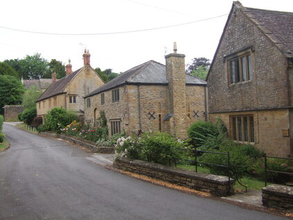
 Thorne Coffin
WALK 12
YEOVIL (PICKETTYWITCH)
Close to the centre of this large town, but surprisingly rural
Country lanes with good views and suburban tarmac paths
Distance 10.7 Km/6.7 miles
Total ascent/descent 135m
www.mapmyrun.com/routes/view/19116966
Revised January 2024 Comments to [email protected]
1 From the bus-stop, Pickettywitch, (GR548 172) (former pub now a Tesco store) walk away from Yeovil 50m and go R on Alastair Drive, bear R to Alastair Close and follow enclosed path ahead to road. Go ahead 100m on enclosed path to reach another road. Go R for 70m cross with care and go down Marsh Lane. Descend gently for 1Km, admiring view from drive of Smoke Acre Farm, to reach crossroads by tree with circular seat [1.5Km]
2 (GR549 186) Go L (SP Yeovil Marsh) and follow road through village for 1Km to reach the busy and fast A37. Cross with care to lane opposite (No Through Road). Follow tarmac 200m to Target Farm then ahead on track 750m to reach road at a T-junction. Go ahead (no sign) 650m past Lower Vagg Farm to reach a cross-roads by the now closed Carpenter’s Arms [2.6Km]
3 (GR526 185) Go ahead (no sign) ascending 1.25Km past a vehicle barrier across the road and the intriguingly named Thorne Coffin(1) with golden stone houses including Thorne House(2) to a T- junction [1.2Km]
4 (GR527 173) Go L (SP Yeovil) and after 250m at roundabout turn R for 200m then L by telecoms mast into Stourton Way. Continue 250m past Forde Park then R by pedestrian lights to follow a tarmac path. After 150m by Jubilee stone take L fork to pass children’s play area and continue ahead 250m to pass houses on the R and a school on L. At road by school entrance go down the path to the L of the house on the opposite side and follow 500m passing the Arrow pub and grass area on the L then ahead to a road. Cross and go ahead into another path for 300m to reach another road. Continue ahead 150m ahead to reach the busy Preston Road, with Preston Plucknett(3) church to the L [2.0Km]
5 (GR534 162) Go down the road to the R of the hairdressing salon opposite and after 70m where the concrete road ends, go L on a tarmac track 300m firstly in front of houses and past grass area on the R. Continue along the pavement then ahead into another track to reach a crossing road. Go ahead (Tithe Court) and after 130m take path to L of number 7. After 100m go ahead along road with airfield(4) behind fence on R. Opposite Century Park, take grassy path between stream and hedge 250m to Westlands(5) Complex. At the end of car-park go ahead along tarmac path for 500m and cross footbridge on L to reach road [1.6Km]
6 (GR549 159) Go L along the road 500m to Preston Grove. Go L 60m then R along Grove Avenue. After 500m by the ex-Services Club, go R 100m then L along Willow Road. Fork R by number 28 and take path ahead 200m to another road. Turn R and after 300m at crossing road take path ahead 250m to reach Pickettywitch (now Tesco). The bus-stops are to the R [1.6Km]
FOR A SHORTER WALK Distance 4.8 Km/3.0 miles
Follow to the end of 1, but turn R for 900m to a T-junction. Go R 1.4 Km to a junction. Go R (Combe St Lane) and after 800m just beyond Marsh Lane, go L along the path to retrace your steps to Pickettywitch.
For car travellers:
Park in Alastair Drive, but do not block any drive.
Refreshments:
The Arrow, Abbey Manor Park
Westlands Entertainment Venue
1 Thorne Coffin acquired its name from the manor of Torne and the Coffin family - originally from Devon, but recorded in Somerset in the 13th Century.
2 Thorne House is Grade II listed and was built in the late 19th century in a neo-Elizabethan style
3 Preston Plucknett church was built in 1420 as a chapel and although the tower is part original the church was substantially rebuilt in the 19th century. It is Grade II* listed.
4 The airfield was opened in 1916 and is operated by Augusta Westland and has a grass runway of 1182m long
5 Westlands, through various mergers, became Augusta Westland a subsidiary of Leonardo, an Italian helicopter company. Their former social club is now an entertainment venue, owned by the local council.
