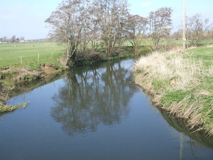
 River Yeo at Mudford
WALK 11
YEOVIL
(COMBE STREET LANE)
A rural walk near Somerset’s second largest town
Plenty of ups and downs on minor roads but not strenuous
Distance 11.5km/7.1miles
Total ascent/descent 126m
www.mapmyrun.com/routes/view/24837216
Updated October 2023 Comments to [email protected]
Note. This walk is mostly on roads and whilst not busy, they are narrow and twisting in places. Take care to be visible to other road users particularly near bends
.
1 From the bus-stop near the eastern end of Combe Street Lane walk east to the road junction at the top of Stone Lane (GR556 177). Turn L down Stone Lane (SP Limington) descending gently for 1.4km.There are pleasant views as you descend to a junction [1.4Km]
2 (GR556 190) Ignore the L turn, but continue ahead (SP Limington) for 200m to another junction. Turn R (SP Mudford Sock) and follow as the road winds past farms and fields for 1.6Km to reach a sharp R bend and then the junction with the busy A359 with a post box opposite.
Go L for 100m and just beyond end of lay-by, cross with care to go over stile opposite (SP Public Footpath). Go over wooden fence and go ahead 400m with hedge on L. Follow the hedge as it starts to bear L then 90 degrees R to reach a hedge gap with a red metal post. Go through gap and go round edge of field keeping hedge on R for 200m to reach a metal gate and road [2.5Km]
3 (GR573 187) Do not go R, but continue ahead through the hamlet of Up Mudford for 400m to junction by post box. Go ahead for a further 500m with views of Manor Farm(1) to the R, and beyond the first row of houses go R along Hales Meadow. After 150m at the end of the road, go through the waymarked fence gap (SP Public Footpath) and cross to the far L corner of the field, passing the playground and skate park. Go L along short track and past car park to emerge on a road opposite Mudford Village Hall(2) [1.3Km]
4 (GR574 198) Cross using the pedestrian crossing and go R 150m along Main St(3) past the Half Moon Inn on the R and turn L (SP Limington). Note the high banks behind which is the R Yeo(4) (and note the depth gauges!) Pass the church(5) and continue 500m to the hamlet of West Mudford. Bear R for 1.2Km to a junction [1.9Km]
5 (GR562 209) Go L (SP Yeovil) and follow the road for 1.9Km past Ashington Wood on the R to a junction. Ignore the turn on the L to Mudford Sock and after a further 200m at another road junction turn R (SP Yeovil Marsh) [2.1Km]
6 (GR556 190) Follow the road for 900m to a junction beyond large farmhouse of Marsh Farm and go L (SP Yeovil) and ascend gently for 1Km to reach Combe Street Lane. Go L for 700m to reach the bus-stop for Yeovil or across the road for Somerton and Wells [2.6Km]
FOR A SHORTER WALK Distance 4.0km/2.5 miles
Follow to the end of point 1. Turn L at junction (SP Yeovil Marsh) and continue from the start of point 6.
For car travellers:
Park with care and consideration in Stone Lane (point 1) or in the free car park opposite Mudford Village Hall and start at point 4
Refreshments:
Half Moon Inn, Mudford
1 Manor Farm House in Up Mudford was built in 1630 on the site of an earlier building destroyed by fire.
2 Mudford Village Hall was built as a single-roomed village school in 1847 and was extended about 50 years later to make separate classrooms for boys and girls. The partly glazed doors separating the rooms are still in use. The school closed in 1947 and later purchased by the village as a centre for ex-servicemen and war memorial
3 Main Street, Mudford has several interesting listed buildings. Details at www.britishlistedbuildings.co.uk
4 R Yeo is a 24km tributary of the R Parrett, which it joins at Langport. In part it forms the boundary between Somerset and Dorset.
5 The Church of St Mary dates from 14th century and is Grade I listed. It was granted to the Bishop of Bath and Wells in 1339 by Montacute Priory. It has a three-stage tower, from 1498 with five 17th century bells from nearby Closworth.
